The Comprehensive Guide to Marine Chart Plotters
Marine chart plotters are essential navigation tools for modern boaters, offering digital charts, GPS integration, and real-time data for safe and efficient maritime travel. This comprehensive guide explores their features, benefits, types, and how to choose the right chart plotter for your vessel, ensuring a seamless and informed boating experience.
Marine chart plotters have revolutionized how mariners navigate the open seas, coastal waters, and inland waterways. These advanced devices combine cutting-edge technology with user-friendly interfaces, providing precise navigation, safety enhancements, and unparalleled convenience. In this article, we’ll delve into everything you need to know about marine chart plotters, from their fundamental components to expert tips on selecting the ideal device for your needs.
1. What Is a Marine Chart Plotter?
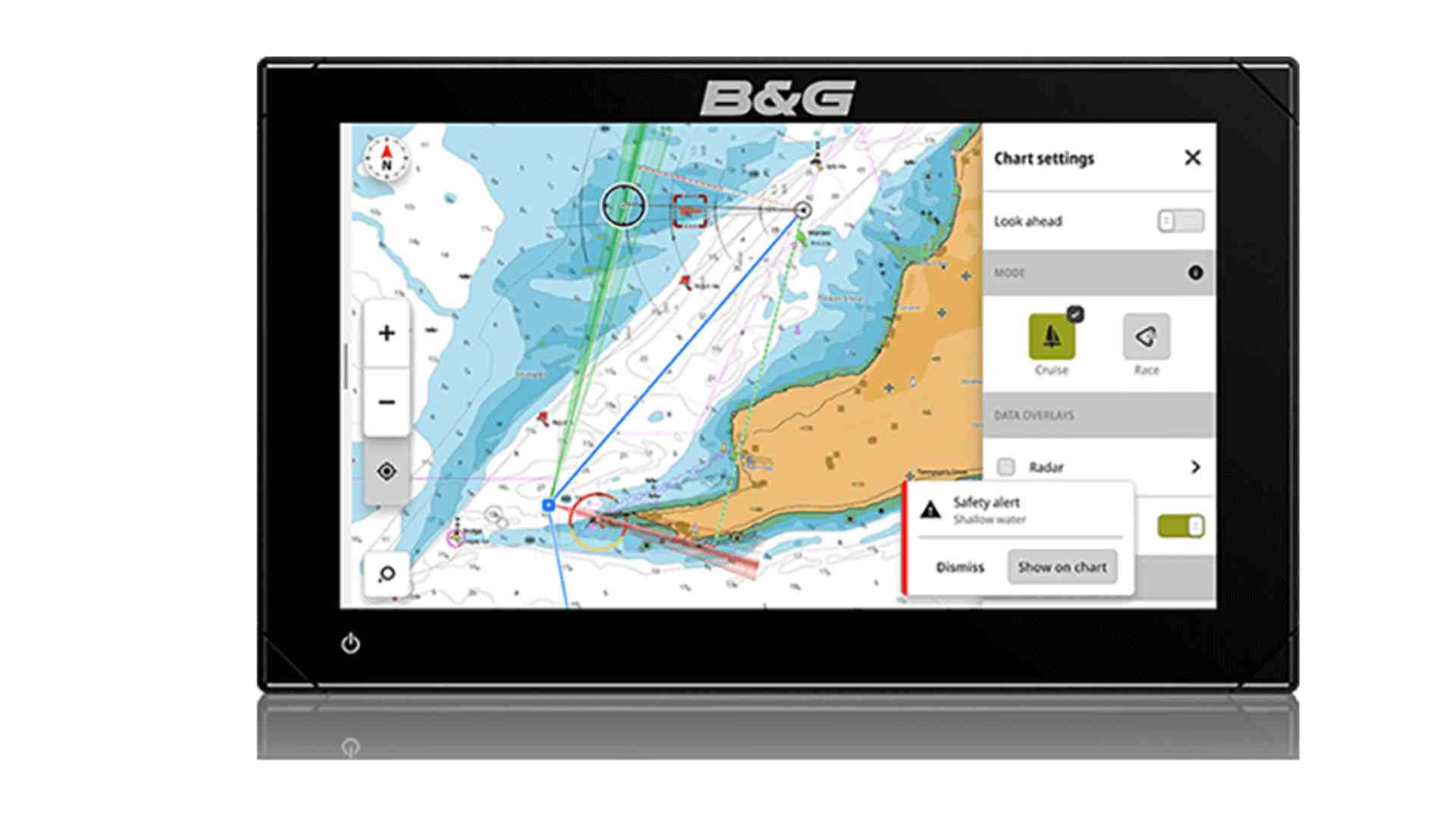
A marine chart plotter is an electronic navigation system that uses digital nautical charts and GPS data to display your boat’s position in real time. These devices act as a digital map, offering detailed information about waterways, depths, hazards, and other navigational aids.
Key Features:
- GPS Integration: Real-time positioning.
- Digital Charts: Interactive and detailed maps of marine environments.
- Route Planning: Customizable routes for efficient navigation.
- Data Overlays: Display of tides, currents, weather, and other real-time data.
2. Types of Marine Chart Plotters
Chart plotters come in various sizes and configurations to suit different boating needs:
- Standalone Chart Plotters: Dedicated devices focused on navigation.
- Multifunction Displays (MFDs): Combine chart plotting with radar, sonar, and other functionalities.
- Portable Chart Plotters: Compact units ideal for small vessels or as backups.
- App-Based Chart Plotters: Smartphone or tablet-based solutions offering flexibility and affordability.
3. Benefits of Marine Chart Plotters
- Enhanced Safety
Chart plotters highlight hazards such as shallow waters, rocks, and wrecks, reducing the risk of accidents. - Accurate Navigation
GPS integration ensures precise positioning, even in unfamiliar waters. - Convenience
Digital charts are easy to update and often include additional features like waypoint marking and real-time alerts. - Integration with Other Systems
Many chart plotters connect with autopilots, fish finders, AIS (Automatic Identification Systems), and radar for a comprehensive navigation setup.
4. Key Features to Look For in a Marine Chart Plotter
- Screen Size and Resolution
A larger, high-resolution screen offers better visibility, especially in bright sunlight. - Chart Compatibility
Ensure the device supports widely-used digital chart formats like Navionics, C-MAP, or NOAA. - Connectivity Options
Look for features like Wi-Fi, Bluetooth, and NMEA 2000 compatibility for easy integration with other systems. - Ease of Use
Intuitive menus and touchscreen functionality make navigation more accessible, even for beginners. - Durability and Water Resistance
A robust design ensures longevity in harsh marine environments.
5. How to Choose the Right Marine Chart Plotter
Selecting the perfect chart plotter depends on several factors:
- Type of Vessel: Larger vessels may benefit from integrated MFDs, while smaller boats might require compact or portable units.
- Boating Activities: Fishing, cruising, or sailing might require specific features like sonar integration or race-route planning.
- Budget: Chart plotters range from basic, affordable models to high-end systems with advanced functionalities.
- Ease of Installation: Some units are plug-and-play, while others require professional installation.
6. Installation and Maintenance Tips
- Professional Installation: For integrated systems, hiring an expert ensures proper setup and functionality.
- Regular Updates: Keep your charts and firmware updated to access the latest navigation data and features.
- Protect the Device: Use protective covers and mount the unit securely to withstand rough conditions.
7. Emerging Trends in Marine Chart Plotters
The marine electronics industry is evolving rapidly, with innovations like:
- Augmented Reality (AR): Overlaying navigation data on live video for enhanced situational awareness.
- Cloud-Based Chart Sharing: Seamless access to updated charts across devices.
- Eco-Friendly Features: Power-efficient devices to minimize environmental impact.
8. Frequently Asked Questions (FAQs)
Can I use a smartphone or tablet as a chart plotter?
Do I need a separate GPS device with a chart plotter?
Are marine chart plotters suitable for beginners?
Conclusion
Marine chart plotters are indispensable for navigating today’s waterways safely and efficiently. Whether you’re a seasoned sailor or a weekend boater, investing in the right chart plotter can transform your maritime experience. By understanding the features, types, and benefits of these devices, you can make an informed decision that meets your unique needs, ensuring every voyage is both enjoyable and secure.
Happy Boating!
Share Marine Chart plotters with your friends and leave a comment below with your thoughts.
Read Make Your Sailing Dream a Reality Today until we meet in the next article.


Thank you for your sharing. I am worried that I lack creative ideas. It is your article that makes me full of hope. Thank you.